
 制图控件
制图控件
# FastWeb制图控件
# 1. TUgAppSVG
此控件可用于显示SVG图形图像。
- SVG 指可伸缩矢量图形 (Scalable Vector Graphics)
- SVG 用来定义用于网络的基于矢量的图形
- SVG 使用 XML 格式定义图形
- SVG 图像在放大或改变尺寸的情况下其图形质量不会有所损失
- SVG 是万维网联盟的标准
- SVG 与诸如 DOM 和 XSL 之类的 W3C 标准是一个整体
关于SVG的定义及使用的方法请参考MDN SVG文档 (opens new window)。
双击可以打开SVG浏览器,选择进行浏览。

# 1.1. 属性
| 属性 | 说明 |
|---|---|
| HTML | 设置SVG图形显示的定义,在此处输入SVG图形的内容 |
| Interval | 设置SVG图形变换的时间间隔,以ms为单位 |
| SVGImgList | 设置SVG图形列表控件的名称,如此处为空,则默认显示HTML中的内容 |
| ThreadEnabled | 是否启用定时器线程,如SVGImgList处未指定,则此项可设置为自旋转 |
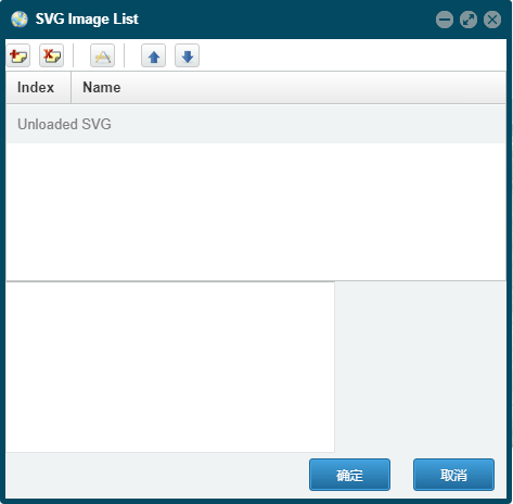
# 2. TUgSVGImgList
此控件用于存储SVG显示的系列,双击可打开管理器管理显示的SVG图形。
# 3. TUgAppAppLeafLetMap
此控件为专业的交互式地图显示控件。
# 3.1. 属性
# 3.1.1. MapOptions
property MapOptions: TMapOptions;
设置地图相关的设置选项。
# 3.1.1.1. AnimationOptions
property AnimationOptions: TAnimationOptions;
动画效果的相关设置项目。这些设置项目仅在地图首次初始化前可设置,初始化后的修改不生效。
| 属性名称 | 类型 | 说明 |
|---|---|---|
| fadeAnimation | Boolean | 是否启用淡出淡出动画,默认为True。 |
| markerZoomAnimation | Boolean | Marker 标记是否使用缩放动画进行缩放,默认为True。 |
| transform3DLimit | Integer | 定义了 CSS 转换的最大尺寸。默认值为223,其取值不应发生变化。 |
| zoomAnimation | Boolean | 是否启用地图缩放动画,默认为True。 |
| zoomAnimationThreshold | Integer | 如果缩放差异超过此值,则不会为缩放设置动画,默认取值为4。 |
# 3.1.1.2. ControlOptions
property ControlOptions: TControlOptions;
控制的相关设置项目。这些设置项目仅在地图首次初始化前可设置,初始化后的修改不生效。
| 属性名称 | 类型 | 说明 |
|---|---|---|
| attrubitionControl | Boolean | 默认情况下,是否将版权控件添加到地图中。 |
| zoomControl | Boolean | 默认情况下,是否将缩放控件添加至地图中。 |
# 3.1.1.3. fullscreenControl
property fullscreenControl: Boolean;
设置是否在地图上添加全屏显示的按钮。此项仅在地图首次初始化前可设置,初始化后的修改不生效。
# 3.1.1.4. InteractionOptions
property InteractionOptions: TInteractionOptions;
设置交互相关的选项。这些设置项目仅在地图首次初始化前可设置,初始化后的修改不生效。
| 属性名称 | 类型 | 说明 |
|---|---|---|
| boxZoom | Boolean | 是否可以在按住 shift 键的同时拖动鼠标将地图缩放到指定的矩形区域。 |
| closePopupOnClick | Boolean | 如果不希望用户点击地图时弹出窗口自动关闭,则可以将其设置为 false。 |
| doubleClickZoom | String | 地图是否可以通过双击来放大,以及在按住 shift 的同时双击来缩小。如果设置为 'center',不管鼠标在哪里,双击缩放都将缩放到视图的中心。 |
| dragging | Boolean | 地图是否可以通过 鼠标/触摸屏 进行拖动。 |
| zoomDelta | Double | 控件在进行缩放的操作时地图缩放的级别改变的数值大小,设置为小于1的数值可以允许缩放更精细化与颗粒化 |
| zoomSnap | Integer | 强制设置地图的缩放级别为这个值的倍数,默认情况下,缩放级别将是其最接近的整数; 数值为0意味着不进行强制设置 |
# 3.1.1.5. KeyboardNavigationOptions
property KeyboardNavigationOptions: TKeyboardNavigationOptions;
设置键盘导航设置的相关选项。这些设置项目仅在地图首次初始化前可设置,初始化后的修改不生效。
| 属性名称 | 类型 | 说明 |
|---|---|---|
| keyboard | Boolean | 地图是否获得焦点,并且允许用户通过键盘和 +/- 来进行浏览地图。 |
| keyboardPanDelta | Integer | 按下方向键时,地图平移的像素数量。 |
# 3.1.1.6. MapStateOptions
property MapStateOptions: TMapStateOptions;
设置地图状态的相关选项。这些设置项目仅在地图首次初始化前可设置,初始化后的修改不生效。
| 属性名称 | 类型 | 说明 |
|---|---|---|
| center | string | 地图初始化时的中心点位置,以数组的形式来表示[30,120] |
| crs | string | 该地图使用的坐标系。如果你不确定此处表示的坐标系是什么意思,请不要更改它。 |
| maxBounds | string | 当这个选项被设置后,地图将被限制在指定的地理边界内, 当用户平移将地图拖动到视图以外的范围时会出现弹回的效果, 并且也不允许缩小视图到指定范围以外的区域(这取决于地图的尺寸) |
| maxZoom | Integer | 地图的最大缩放级别。 |
| minZoom | Integer | 地图的最小缩放级别。 |
| renderer | string | 在地图上绘制矢量图层的默认方法,默认为 L.SVG 或 L.Canvas, 这取决于浏览器是否支持。 |
| zoom | Integer | 设置地图初始化时的缩放等级。 |
# 3.1.1.7. MouseWheelOptions
property MouseWheelOptions: TMouseWheelOptions;
设置地图鼠标滚轮操作的相关选项。这些设置项目仅在地图首次初始化前可设置,初始化后的修改不生效。
| 属性名称 | 类型 | 说明 |
|---|---|---|
| scrollWheelZoom | string | 地图是否允许通过使用鼠标滚轮进行缩放。如果设置为'center',不管鼠标在哪里,都将会放大到视图的中心。 |
| wheelDebounceTime | Integer | 限制滚轮的触发速度(以毫秒为单位)。默认情况下,用户通过滚轮缩放的次数间隔不能小于 40 毫秒。 |
| wheelPxPerZoomLevel | Integer | 多少滚动像素意味着一个完整缩放级别的更改。 较小的值将使滚轮变焦更快(反之亦然)。 |
# 3.1.1.8. PanningInertiaOptions
property PanningInertiaOptions: TPanningInertiaOptions;
设置在修改地图中心的方法中使用到的相关选项。这些设置项目仅在地图首次初始化前可设置,初始化后的修改不生效。
| 属性名称 | 类型 | 说明 |
|---|---|---|
| easeLinearity | Double | 平移动画缓动的曲率因子(三次贝塞尔曲线的一个参数)。1.0 表示线性动画,这个数字越小,曲线越弯曲。 |
| inertia | Boolean | 如果启用,地图的平移会有一种惯性效应,即地图在拖动时形成动力,并在一段时间内继续向同一方向移动。此项设置可提高在触摸屏设备上的使用体验。默认情况下是启用的。 |
| inertiaDeceleration | Integer | 惯性运动减速的速度,以像素/秒为单位。 |
| inertiaMaxSpeed | Integer | 惯性运动的最大速度,以像素/秒为单位。 |
| maxBoundsViscosity | Integer | 如果设置了 maxBounds,这个选项将控制拖动地图时边界的稳固程度。默认值为 0.0,允许用户以正常速度在界外拖动,更高的值会减慢地图在界外的拖动速度,而 1.0 使界外完全稳固,防止用户在界外拖动。 |
| worldCopyJump | Boolean | 启用该选项后,当你平移到世界的另一个 "copy" 时,地图会跟踪并无缝跳转到原来的副本,这样所有的覆盖物如 markers(标记)和 vector layers(矢量图层)都仍然可见。 |
# 3.1.1.9. preferCanvas
property preferCanvas: Boolean;
是否使用 Canvas 来渲染 Path(路径)。默认情况下,所有 Path 都是使用 SVG 进行渲染。
# 3.1.1.10. TouchInterationOptions
property TouchInterationOptions: TTouchInterationOptions;
设置地图触摸交互的相关选项。这些设置项目仅在地图首次初始化前可设置,初始化后的修改不生效。
| 属性名称 | 类型 | 说明 |
|---|---|---|
| bounceAtZoomLimits | Boolean | 如果您不希望在地图缩放超过最小/最大缩放范围时反弹,请将其设置为 false。 |
| tap | Boolean | 是否启用 mobile hacks 以支持 taps(在 iOS / Android上 修复 200ms 点击延迟)和 touch(触发 contextmenu 事件)。 |
| taptolerance | Integer | 用户在触摸时,移动手指的像素数超过此值时被认为是有效的 tap。 |
| touchZoom | string | 地图是否允许通过两根手指的触摸拖动进行缩放。如果通过 'center',就会放大到视图的中心,而不管 touch 事件(手指)在哪里。对具有 touch-capable 功能的网络浏览器来说是启用的。 |
# 3.2. 事件
| 事件名称 | 触发条件 |
|---|---|
| OnMarkerClick | 当点击地图中的标记时触发事件 |
| OnMapClick | 当点击地图上的内容时触发事件 |
| OnMapLocation | 当地图定位时触发事件 |
| OnCurrentPosition | 设置当前定位时触发事件 |
# 3.3. 方法
# 3.3.1. InitMap
procedure InitMap;
调用此方法后,地图控件将初始化。
# 3.3.2. GetCenter
procedure GetCenter;
获取
# 3.3.3. GetCurrentPosition
procedure GetCurrentPosition;
获取当前地图的定位信息。
# 3.3.4. PrintMap
procedure PrintMap;
调用地图的打印功能。
# 3.3.5. AddNavBar
procedure AddNavBar;
在地图中添加导航栏的组件。
# 3.3.6. AddScale
procedure AddScale;
在地图中添加比例尺的组件。
# 3.3.7. SetView
procedure SetView(Lat: string; Lng: string; maxZoom: Integer; Options: string);
用指定的动画选项来设置地图的视图。
//JScript
//将地图的中心定位至指定的经纬度,并调整其缩放级别。
UgAppLeafLetMap01.setView("39.924317","116.390619",13);
2
3
//PasScript
//将地图的中心定位至指定的经纬度,并调整其缩放级别。
UgAppLeafLetMap01.setView('39.924317','116.390619',13);
2
3
// Make sure to add code blocks to your code group
# 3.3.8. SetZoom
procedure SetZoom(Zoom: Integer; Options: string);
设置地图的缩放级别。
//JScript
//设置放大级别
UgAppLeafLetMap01.SetZoom(18);
2
3
//PasScript
//设置放大级别
UgAppLeafLetMap01.SetZoom(18);
2
3
// Make sure to add code blocks to your code group
# 3.3.9. ZoomIn
procedure ZoomIn(Zoom: Integer; Options: string);
设置放大地图级别的数量。
//JScript
//放大
UgAppLeafLetMap01.ZoomIn(1);
2
3
//PasScript
//放大
UgAppLeafLetMap01.ZoomIn(1);
2
3
// Make sure to add code blocks to your code group
# 3.3.10. ZoomOut
procedure ZoomOut(Zoom: Integer; Options: string);
设置缩小地图级别的数量。
//JScript
//缩少
UgAppLeafLetMap01.ZoomOut(1);
2
3
//PasScript
//缩少
UgAppLeafLetMap01.ZoomOut(1);
2
3
// Make sure to add code blocks to your code group
# 3.3.11. SetZoomAround
procedure SetZoomAround(Lat: string; Lng: string; Zoom: Integer; Options: string)
设置缩放地图,同时保持地图上的指定地理位置不变(功能类似于滚动缩放和双击缩放操作)。
# 3.3.12. FitBounds
procedure FitBounds(LatLngBounds: string; Options: string);
将地图的视图设置在给定的矩形地理范围内,地图会自动计算最大缩放级别和中心点。
# 3.3.13. FitWorld
procedure FitWorld(Options: string);
设置一个包含整个世界的地图视图,其缩放级别为最大。
# 3.3.14. PanTo
procedure PanTo(Lat: string; Lng: string; Options: string);
将地图平移到一个指定的中心点。
# 3.3.15. SetMinZoom
procedure SetMinZoom(zoom: Integer);
设定地图的最小缩放级别。
# 3.3.16. SetMaxZoom
procedure SetMaxZoom(zoom: Integer);
设定地图的最大缩放级别。
# 3.3.17. Locate
procedure Locate(setView: Boolean; maxZomm: Integer; watch: Boolean; timeout: Integer; maximumAge: Integer; enableHighAccuracy: Boolean);
获取当前设备的定位信息,此方法要求浏览器访问的网站运行在https模式下。
| 选项 | 类型 | 默认 | 说明 |
|---|---|---|---|
| watch | Boolean | false | 如果为 true,则开始使用 W3C watchPosition 方法连续观察位置变化(而不是检测一次)。之后你可以使用 StopLocate 方法停止观察。 |
| setView | Boolean | false | 如果为 true,则根据检测精度自动将地图视图设置为用户位置,如果地理定位失败,则自动设置为世界视图。 |
| maxZoom | Integer | Infinity | 使用 setView 选项时,自动视图设置的最大缩放。 |
| timeout | Integer | 10000 | 在触发 locationerror 事件之前等待来自地理位置响应的毫秒数 。 |
| maximumAge | Integer | 0 | 检测到的位置的最大时长。如果自上次地理定位响应以来经过的毫秒数少于此毫秒数,locate 则将返回缓存的位置。 |
| enableHighAccuracy | Boolean | false | 启用高精度 |
# 3.3.18. StopLocate
procedure StopLocate;
使用此方法后,停止定位。
# 3.3.19. AddTileLayer
procedure AddTilelayer(value: TTileLayer);
使用此方法可在地图上加载瓦片图层。
//JScript
  var TileLayer,TileLayer1;
  //创建图层配置
  TileLayer= new TTileLayer();
  TileLayer.Id = "1";
  TileLayer.tileLayer = "https://tile.openstreetmap.org/{z}/{x}/{y}.png";
  TileLayer.minZoom = 1;
  TileLayer.maxZoom = 18;
  TileLayer.noWrap = true;
  //创建瓦片图层
  UgAppLeafLetMap01.AddTilelayer(TileLayer);

  //创建图层配置
  TileLayer1= new TTileLayer();
  TileLayer1.Id = "2";
  TileLayer1.tileLayer = "https://api.mapbox.com/styles/v1/mapbox/satellite-v9/tiles/{z}/{x}/{y}?access_token={TOKEN}";
  TileLayer1.minZoom = 1;
  TileLayer1.maxZoom = 18;
  TileLayer1.noWrap = true;
  //创建瓦片图层
  UgAppLeafLetMap01.AddTilelayer(TileLayer1);
2
3
4
5
6
7
8
9
10
11
12
13
14
15
16
17
18
19
20
21
//PasScript
Var
  TileLayer,TileLayer1:TTileLayer;
begin
  //创建图层配置
  TileLayer:=TTileLayer.Create;
  TileLayer.Id := '1';
  TileLayer.tileLayer := 'https://tile.openstreetmap.org/{z}/{x}/{y}.png';
  TileLayer.minZoom := 1;
  TileLayer.maxZoom := 18;
  TileLayer.noWrap := true;
  //创建瓦片图层
  UgAppLeafLetMap01.AddTilelayer(TileLayer);

  //创建图层配置
  TileLayer1:=TTileLayer.Create;
  TileLayer1.Id := '2';
  TileLayer1.tileLayer := 'https://api.mapbox.com/styles/v1/mapbox/satellite-v9/tiles/{z}/{x}/{y}?access_token={TOKEN}';
  TileLayer1.minZoom := 1;
  TileLayer1.maxZoom := 18;
  TileLayer1.noWrap := true;
  //创建瓦片图层
  UgAppLeafLetMap01.AddTilelayer(TileLayer1);
end;
2
3
4
5
6
7
8
9
10
11
12
13
14
15
16
17
18
19
20
21
22
23
24
// Make sure to add code blocks to your code group
其中的瓦片图层使用的URL地址为以下的格式:
'http://{s}.somedomain.com/blabla/{z}/{x}/{y}{r}.png'
{s} 是指可用的子域之一(按顺序使用,以帮助解决每个域的浏览器并行请求限制;子域值在选项中指定;默认为 a, b 或 c , 可以省略), {z} — 缩放级别, {x} 和 {y} — 瓦片坐标。 {r} 可以用来在URL中添加 "@2x" 以加载视网膜瓦片。
# 3.3.20. LayerGroupAddLayer
procedure LayerGroupAddLayer(Id: string)
将给定的图层添加到组中。
//JScript
  UgAppLeafLetMap01.LayerGroupAddLayer("1");
  UgAppLeafLetMap01.LayerGroupAddLayer("2");
  UgAppLeafLetMap01.MapAddLayerGroup;
  UgAppLeafLetMap01.MapAddControlLayers;
2
3
4
5
//PasScript
begin
  UgAppLeafLetMap01.LayerGroupAddLayer('1');
  UgAppLeafLetMap01.LayerGroupAddLayer('2');
  UgAppLeafLetMap01.MapAddLayerGroup;
  UgAppLeafLetMap01.MapAddControlLayers;
end;
2
3
4
5
6
7
// Make sure to add code blocks to your code group
# 3.3.21. FeatureGroupAddLayer
procedure FeatureGroupAddLayer(Id: string);
将给定的图层添加至要素组中。
# 3.3.22. MapAddTileLayer
procedure MapAddTilelayer(Id: string);
为地图添加给定的瓦片图层。
# 3.3.23. MapAddLayerGroup
procedure MapAddLayerGroup;
为地图添加特定的组。
# 3.3.24. MapAddFeatureGroup
procedure MapAddFeatureGroup;
为地图添加特定的要素组。
# 3.3.25. MapAddControlLayers
procedure MapAddControlLayers;
为地图添加控制层。
# 3.3.26. SpeedUp
procedure SpeedUp;
加快标记的移动速度。
# 3.3.27. SpeedDown
procedure SpeedDown;
减慢标记的移动速度。
# 3.3.28. Start
procedure Start;
设置开始移动标记。
# 3.3.29. Pause
procedure Pause;
设置暂停移动标记。
# 3.3.30. Stop
procedure Stop;
设置停止移动标记。
# 3.3.31. AddMarker
procedure AddMarker(value: TMarker);
在地图上添加一个标记。
//JScript
 var Marker,Icon;
 //创建图标
 Icon = new TBaseIcon();
 Icon.IconUrl = "files/car_red.png";
 //创建Marker
 Marker = TMarker;
 Marker.Id = "2";
 Marker.Keyboard = true;
 Marker.Title = "";
 Marker.Alt = " ";
 Marker.Lat = "30.675048";
 Marker.Lng = "120.604017";
 Marker.Icon = Icon.ToString;
 UgAppLeafLetMap01.AddMarker(Marker);
2
3
4
5
6
7
8
9
10
11
12
13
14
15
//PasScript
Var
 Marker:TMarker;
 Icon:TBaseIcon;
begin
 //创建图标
 Icon:= TBaseIcon.Create;
 Icon.IconUrl := 'files/car_red.png';
 //创建Marker
 Marker := TMarker.Create;
 Marker.Id := '2';
 Marker.Keyboard := true;
 Marker.Title := '';
 Marker.Alt := ' ';
 Marker.Lat := '30.675048';
 Marker.Lng := '120.604017';
 Marker.Icon := Icon.ToString;
 UgAppLeafLetMap01.AddMarker(Marker);
end;
2
3
4
5
6
7
8
9
10
11
12
13
14
15
16
17
18
19
// Make sure to add code blocks to your code group
# 3.3.32. DeleteAllMarker
procedure DeleteAllMarker;
删除地图上所有的标记信息。
# 3.3.33. DeleteMarker
procedure DeleteMarker(Id: string);
删除指定的地图标记。
# 3.3.34. SetMarkerPosition
procedure SetMarkerPosition(Id: string; Lat: string; Lng: string);
设置指定的地图标记指向的地理位置。
UgAppLeafLetMap01.SetMarkerPosition('1','30.675048','120.604017');
# 3.3.35. SetMarkerPopupContent
procedure SetMarkerPopupContent(Id: string; Content: string);
设置地图标记对应的弹出窗口中显示的文本内容。
//JScript
 var Marker,Circle;
 Marker = new TMarker();
 Marker.Id = "location";
 Marker.Lat = lat;
 Marker.Lng = lng;
 UgAppLeafLetMap01.AddMarker(Marker);

 Circle= new TCircle();
 Circle.Id = "location";
 Circle.LatLngs = "["+lat+","+lng+"]";
 Circle.Radius = trunc(StrToFloat(radius));
 UgAppLeafLetMap01.AddCircle(circle);
 UgAppLeafLetMap01.SetMarkerPopupContent("location","You are in " +radius+ " meters radius");
2
3
4
5
6
7
8
9
10
11
12
13
14
//PasScript
procedure UgAppLeafLetMap01OnMapLocation(sender: tobject;lat: string;lng: string;radius: string);
Var
 Marker:TMarker;
 Circle:TCircle;
begin
 Marker := TMarker.Create;
 Marker.Id := 'location';
 Marker.Lat := lat;
 Marker.Lng := lng;
 UgAppLeafLetMap01.AddMarker(Marker);

 Circle:=TCircle.Create;
 Circle.Id := 'location';
 Circle.LatLngs := '['+lat+','+lng+']';
 Circle.Radius := trunc(StrToFloat(radius));
 UgAppLeafLetMap01.AddCircle(circle);
 UgAppLeafLetMap01.SetMarkerPopupContent('location','You are in ' +radius+ ' meters radius');
end;
2
3
4
5
6
7
8
9
10
11
12
13
14
15
16
17
18
19
// Make sure to add code blocks to your code group
# 3.3.36. SetMarkerTooltipContent
procedure SetMarkerTooltipContent(Id: string; Content: string);
设置与地图标记绑定的工具提示显示的内容。
//JScript
UgAppLeafLetMap01.SetMarkerTooltipContent("1","I am here~~~");
2
//PasScript
UgAppLeafLetMap01.SetMarkerTooltipContent('1','I am here~~~');
2
// Make sure to add code blocks to your code group
# 3.3.37. AddPopup
procedure AddPopup(value: TPopup);
添加弹出对话框组件。
//JScript
  var Popup;
  Popup= new TPopup();
  Popup.Id = "1";
  Popup.Lat = "30.675048";
  Popup.Lng = "120.604017";
  Popup.Content = "<p>I am the First Popup<p>This is the Second</br>";
  UgAppLeafLetMap01.AddPopup(Popup);
2
3
4
5
6
7
8
//PasScript
Var
 Popup:TPopup;
begin
  Popup:=TPopup.Create;
  Popup.Id := '1';
  Popup.Lat := '30.675048';
  Popup.Lng := '120.604017';
  Popup.Content := '<p>I am the First Popup<p>This is the Second</br>';
  UgAppLeafLetMap01.AddPopup(Popup);
end;
2
3
4
5
6
7
8
9
10
11
// Make sure to add code blocks to your code group
# 3.3.38. DeleteAllPopup
procedure DeleteAllPopup;
删除所有的弹出对话框组件。
# 3.3.39. DeletePopup
procedure DeletePopup(Id: string);
删除指定的对话框组件。
# 3.3.40. SetPopupPosition
procedure SetPopupPosition(Id: string; Lat: string; Lng: string);
设置绑定的弹出对话框组件显示的经纬度位置。
# 3.3.41. SetPopupContent
procedure SetPopupContent(Id: string; Content: string);
设置绑定的弹出对话框组件显示的文本内容。
# 3.3.42. AddPolyline
procedure AddPolyline(value: TPolyline);
在地图中添加折线。
//JScript
  var Polyline;
  Polyline= new TPolyline();
  Polyline.Id = "1";
  Polyline.LatLngs = "[[31.51, 120.68],[32.77, 122.43]]";
  Polyline.Color = "green";
  UgAppLeafLetMap01.AddPolyline(Polyline);
2
3
4
5
6
7
//PasScript
Var
  Polyline:TPolyline;
begin
  Polyline:=TPolyline.Create;
  Polyline.Id := '1';
  Polyline.LatLngs := '[[31.51, 120.68],[32.77, 122.43]]';
  Polyline.Color := 'green';
  UgAppLeafLetMap01.AddPolyline(Polyline);
end;
2
3
4
5
6
7
8
9
10
// Make sure to add code blocks to your code group
# 3.3.43. DeleteAllPolyline
procedure DeleteAllPolyline;
删除所有的折线。
# 3.3.44. DeletePolyline
procedure DeletePolyline(Id: string);
删除指定的折线。
# 3.3.45. AddPolylineLatLng
procedure AddPolylineLatLng(Id: string; LatLng: string);
为指定的折线图形根据目标经纬度的坐标点添加折线。
# 3.3.46. AddPolygon
procedure AddPolygon(value: TPolygon);
在地图中添加一个多边形。
//JScript
  var Polygon;
  Polygon= new TPolygon();
  Polygon.Id = "1";
  Polygon.LatLngs = "[[30.51, 120.68],[37.77, 122.43],[34.04, 118.2]]";
  Polygon.Color = "red";
  UgAppLeafLetMap01.AddPolygon(Polygon);
2
3
4
5
6
7
//PasScript
Var
  Polygon:TPolygon;
begin
  Polygon:=TPolygon.Create;
  Polygon.Id := '1';
  Polygon.LatLngs := '[[30.51, 120.68],[37.77, 122.43],[34.04, 118.2]]';
  Polygon.Color := 'red';
  UgAppLeafLetMap01.AddPolygon(Polygon);
end;
2
3
4
5
6
7
8
9
10
// Make sure to add code blocks to your code group
# 3.3.47. DeleteAllPolygon
procedure DeleteAllPolygon;
删除地图上所有的多边形。
# 3.3.48. DeletePolygon
procedure DeletePolygon(Id: string);
删除地图上指定的多边形。
# 3.3.49. AddPolygonLatLng
procedure AddPolygonLatLng(Id: string; LatLng: string);
为指定的多边形根据目标经纬度的坐标点添加折线。
# 3.3.50. AddRectangle
procedure AddRectangle(value: TRectangle);
为地图添加矩形。
//JScript
  var Rectangle;
  Rectangle= new TRectangle();
  Rectangle.Id = "1";
  //给定矩形指定的边界,合围的区域就是矩形
  Rectangle.LatLngs = "[[54.559322, -5.767822], [56.1210604, -3.021240]]";
  Rectangle.Color = "red";
  Rectangle.Weight = 1;
  UgAppLeafLetMap01.AddRectangle(Rectangle);
2
3
4
5
6
7
8
9
//PasScript
Var
  Rectangle:TRectangle;
begin
  Rectangle:=TRectangle.Create;
  Rectangle.Id := '1';
  //给定矩形指定的边界,合围的区域就是矩形
  Rectangle.LatLngs := '[[54.559322, -5.767822], [56.1210604, -3.021240]]';
  Rectangle.Color := 'red';
  Rectangle.Weight := 1;
  UgAppLeafLetMap01.AddRectangle(Rectangle);
end;
2
3
4
5
6
7
8
9
10
11
12
// Make sure to add code blocks to your code group
# 3.3.51. DeleteAllRectangle
procedure DeleteAllRectangle;
删除所有的矩形。
# 3.3.52. DeleteRectangle
procedure DeleteRectangle(Id: string);
删除矩形。
# 3.3.53. AddRectangleLatLng
procedure AddRectangleLatLng(Id: string; LatLng: string)
根据给定的经纬度位置添加一个边。
# 3.3.54. AddCircle
procedure AddCircle(value: TCircle);
添加一个圆形。
//JScript
  var Circle;
  Circle= new TCircle();
  Circle.Id = "1";
  //圆中心点的位置
  Circle.LatLngs = "[30.675048,120.604017]";
  //圆的半径,以米为单位
  Circle.Radius = 200;
  UgAppLeafLetMap01.AddCircle(Circle);
2
3
4
5
6
7
8
9
//PasScript
Var
  Circle:TCircle;
begin
  Circle:=TCircle.Create;
  Circle.Id := '1';
  //圆中心点的位置
  Circle.LatLngs := '[30.675048,120.604017]';
  //圆的半径,以米为单位
  Circle.Radius := 200;
  UgAppLeafLetMap01.AddCircle(Circle);
end;
2
3
4
5
6
7
8
9
10
11
12
// Make sure to add code blocks to your code group
# 3.3.55. DeleteAllCircle
procedure DeleteAllCircle;
删除所有的圆。
# 3.3.56. DeleteCircle
procedure DeleteCircle(Id: string);
删除指定的圆。
# 3.3.57. SetCirclePosition
procedure SetCirclePosition(Id: string; Lat: string; Lng: string)
重新设定绑定的圆形的位置。
# 3.3.58. SetCircleRadius
procedure SetCircleRadius(Id: string; Radius: Integer);
重新设定指定的圆的半径。
# 3.3.59. AddCircleMarker
procedure AddCircleMarker(value: TCircleMarker);
添加一个带圆中心点的标记。
//JScript
  var CircleMarker;
  CircleMarker= new TCircleMarker();
  CircleMarker.Id = "1";
  CircleMarker.LatLngs = "[30.675048,120.604017]";
  CircleMarker.Radius = 200;
  UgAppLeafLetMap01.AddCircleMarker(CircleMarker);
2
3
4
5
6
7
//PasScript
Var
  CircleMarker:TCircleMarker;
begin
  CircleMarker:=TCircleMarker.Create;
  CircleMarker.Id := '1';
  CircleMarker.LatLngs := '[30.675048,120.604017]';
  CircleMarker.Radius := 200;
  UgAppLeafLetMap01.AddCircleMarker(CircleMarker);
end;
2
3
4
5
6
7
8
9
10
// Make sure to add code blocks to your code group
# 3.3.60. DeleteAllCircleMarker
procedure DeleteAllCircleMarker;
删除所有的带标记的圆。
# 3.3.61. SetCircleMarkerPosition
procedure SetCircleMarkerPosition(Id: string; Lat: string; Lng: string)
重新设定标记圆标定的位置。
# 3.3.62. SetCircleMarkerRadius
procedure SetCircleMarkerRadius(Id: string; Radius: Integer)
重新设定标记圆标定的半径。
# 3.3.63. AddImageOverlay
procedure AddImageOverlay(value: TImageOverlay);
添加图片的图层。
//JScript
  var ImageOverlay;
  ImageOverlay= new TImageOverlay();
  ImageOverlay.Id = "1";
  ImageOverlay.Url = "files/car_red.png";
  ImageOverlay.Bounds = "[[ 30, 120], [ 31.5, 121.88]]";
  UgAppLeafLetMap01.AddImageOverlay(ImageOverlay);
  UgAppLeafLetMap01.setZoom(8);
2
3
4
5
6
7
8
//PasScript
Var
 ImageOverlay:TImageOverlay;
begin
    ImageOverlay:=TImageOverlay.Create;
    ImageOverlay.Id := '1';
    ImageOverlay.Url := 'files/car_red.png';
    ImageOverlay.Bounds := '[[ 30, 120], [ 31.5, 121.88]]';
    UgAppLeafLetMap01.AddImageOverlay(ImageOverlay);
    UgAppLeafLetMap01.setZoom(8);
end;
2
3
4
5
6
7
8
9
10
11
// Make sure to add code blocks to your code group
# 3.3.64. DeleteAllImageOverlay
procedure DeleteAllImageOverlay;
删除所有的图片图层。
# 3.3.65. DeleteImageOverlay
procedure DeleteImageOverlay(Id: string);
删除指定的图片图层。
# 3.3.66. SetImageOverlayBounds
procedure SetImageOverlayBounds(Id: string; LatLng: string)
设定图片图层显示的边界。
# 3.3.67. AddVideoOverlay
procedure AddVideoOverlay(value: TVideoOverlay);
添加视频的图层。
//JScript
  var videoOverlay;
  videoOverlay= new TVideoOverlay();
  videoOverlay.Id = "1";
  videoOverlay.Url = "https://vod.300hu.com/4c1f7a6atransbjngwcloud1oss/6ceb8e64340179614968700929/v.f30.mp4";
  videoOverlay.Bounds = "[[ 30, 120], [ 31.5, 121.88]]";
  UgAppLeafLetMap01.AddVideoOverlay(videoOverlay);
  UgAppLeafLetMap01.setZoom(8);
2
3
4
5
6
7
8
//PasScript
Var
 videoOverlay:TVideoOverlay;
begin
    videoOverlay:=TVideoOverlay.Create;
    videoOverlay.Id := '1';
    videoOverlay.Url := 'https://vod.300hu.com/4c1f7a6atransbjngwcloud1oss/6ceb8e64340179614968700929/v.f30.mp4';
    videoOverlay.Bounds := '[[ 30, 120], [ 31.5, 121.88]]';
    UgAppLeafLetMap01.AddVideoOverlay(videoOverlay);
    UgAppLeafLetMap01.setZoom(8);
end;
2
3
4
5
6
7
8
9
10
11
// Make sure to add code blocks to your code group
# 3.3.68. DeleteAllVideoOverlay
procedure DeleteAllVideoOverlay;
删除所有的视频图层。
# 3.3.69. DeleteVideoOverlay
procedure DeleteVideoOverlay(Id: string);
删除指定的视频图层。
# 3.3.70. SetVideoOverlayBounds
procedure SetVideoOverlayBounds(Id: string; LatLng: string);
设置视频图层的边界。